Fire Threat Map of California
Threat Map
The State of California and Cal Fire have developed maps available online for you to view fire risk areas. These maps are updated regularly. Link to CPUC High Fire Threat District. Link to Cal Fire’s Fire hazard Severity Zone Map. These maps show areas with varying degrees of wildfire risks.
PG&E has introduced a safety site with helpful information about wildfire preparedness, vegetation management, gas safety, and much more. Visit PG&E Safety site. To report possible safety issues you can download PG&E’s Report It.
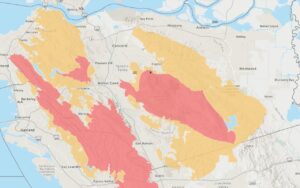
Contra Costa Fire Threat Map
Tips
Listos Safety Tips for Wildfire + COVID-19 (6 page PDF) in English, Chinese, Filipino, Hmong, Korean, Spanish, and Vietnamese.